ScanAxis · Quebec
Reinforced concrete corrosion mapping
Corrosion mapping places observations and measurements related to reinforcement corrosion on a plan. It helps identify areas for further investigation and supports repair priorities with the engineer. ScanAxis offers this service in Quebec, with the method and survey limits defined for each assignment.
Request a quote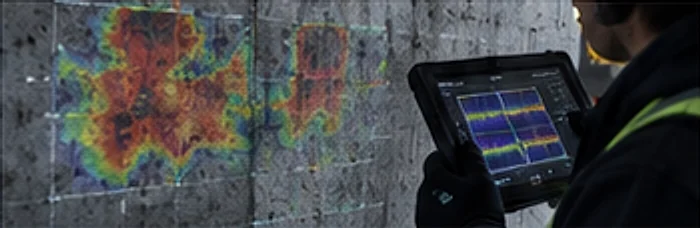
Why investigate corrosion
Rust stains, cracks and spalling can motivate investigation. The absence of visible damage does not establish that reinforcement is intact.
Mapping connects measurements to locations so that a single observation is not extrapolated to an entire slab.
Investigation methods
These are examples of investigation methods, not a list of ScanAxis equipment or included services.
| Method | Information | Limit |
|---|---|---|
| GPR | Locations and signal variations | Indirect indications requiring interpretation. |
| Half-cell potential | Potentials associated with corrosion activity | Measurement conditions and electrical access matter. |
| Acoustic sounding | Delamination indications | Does not describe all corrosion activity. |
| Chloride analysis | Chlorides in samples | Local results requiring sampling. |
Corrosion mapping use cases
Mapping is most useful when reinforced concrete is exposed to moisture and salts, or when a repair program needs to be prioritized.
Underground or multi-level parking
Locate areas for further examination before preparing a repair program with the engineer.
Slabs exposed to de-icing salts
Document how indications are distributed across a surface exposed to water and salts carried in by vehicles.
Balconies, walkways and terraces
Target areas for investigation when spalling or rust stains appear.
Monitoring over time
Compare successive surveys performed with consistent references and methods.
From survey to corrosion map
Mapping relies on measurements taken at known positions. Survey lines or points are tied to the structure’s geometry, then plotted on a plan to show how results are distributed.
With GPR, the reflection amplitude from the top reinforcement layer can be analysed across the area. Stronger attenuation than in neighbouring areas may indicate wetter or more chloride-laden concrete, conditions often associated with corrosion risk. These indications remain indirect.
The map is best cross-checked with other data, such as visual observations, delamination sounding, potential measurements or samples, depending on the methods selected for the assignment.
- Low indication
- Intermediate indication
- High indication
- Measurement cell tied to the plan
- Area to investigate first
- Unmeasured area, congested or inaccessible
- Column used as a reference
Fictional illustration, not to scale and not survey data. Classes on a real map are read with its legend and method.
Referencing
Tie the measurement grid to columns, joints or other plan references.
Data collection
Cover accessible areas and record those that cannot be measured.
Processing
Process and classify measurements to produce a readable map with its legend.
Cross-checking
Compare the map with observations and complementary tests before drawing conclusions.
Limits of corrosion mapping
A map reflects conditions at the time of the survey. Moisture, temperature and surface condition can influence some measurements, and two surveys are only comparable if these conditions are documented.
Congested, covered or inaccessible areas are not shown, or are shown with lower reliability. The deliverable should identify them clearly so results are not extrapolated.
Reading a corrosion map
Read colours with the legend, method, measurement conditions and limitations. A probability class is not a percentage of steel section loss.
Potential measurements do not determine the structural properties of steel or reinforced concrete. Additional data may be needed to interpret activity and consequences.
Deliverables and repair planning
Agree on plans, coverage, presentation and the engineer’s requirements before the survey. Located findings support comparisons and additional investigation.
Repair quantities, specifications and cost estimates require appropriate diagnosis. Visible deterioration alone does not establish the repair scope.
When to request mapping
Describe observed conditions and the decision you need to make.
- Before parking garage repairs
- After observing rust stains or spalling
- When documenting changes in a structure
- Alongside structural assessment
Verifiable facts
Information you can check.
The methods, regulatory framework and contact details shown here link to public sources. No review or certification is displayed without verification.
Technical references
The methods described on this site are presented in these public references.
Regulatory framework
The Régie du bâtiment du Québec oversees the maintenance and verification of parking garages.
RBQAreas served
Surveys offered in these Quebec cities:
- Montreal
- Laval
- Longueuil
- Quebec City
- Gatineau
- Sherbrooke
- Trois-Rivières
- Saguenay
- Drummondville
Direct contact
Reach the ScanAxis team by phone or email.
Frequently asked questions
How does detection differ from mapping?
Detection seeks indications or measurements associated with corrosion. Mapping locates them on a plan to compare their distribution.
Is corrosion always visible?
No. Surface condition alone does not describe reinforcement condition. Interpretation depends on the test method and any complementary investigations.
Must the parking garage be emptied?
Access and occupancy constraints must be agreed with the manager. Phased access depends on the assignment.
Does the report provide a repair cost?
Findings document surveyed areas. Repair estimates depend on diagnosis, specifications and the responsible project professionals.
Does GPR directly measure corrosion?
No. It locates reinforcement and reflection variations that may be associated with conditions favourable to corrosion. Other measurements, such as half-cell potential or chloride analysis, may be needed to draw conclusions about corrosion activity.
Can mapping track changes in a structure?
Yes, when successive surveys use the same references, a comparable method and documented conditions. Keep the grid plan and first-survey parameters to make comparison easier.
Does a waterproofing membrane prevent mapping?
It can limit some measurements, especially those requiring electrical contact with the concrete. With GPR, readings through the covering are sometimes possible depending on the material. Feasibility is confirmed on a trial area.
Read more on this service
Articles that develop a specific point of this service.
- September 14, 2026Parking garage slab assessment in Quebec and when to schedule oneA parking garage slab assessment is a non-destructive evaluation of a suspended concrete deck's condition, using methods like ground-penetrating radar and corrosion mapping. In Quebec, elevated parking structures need a documented owner check each year plus periodic engineer verification to confirm the slab remains structurally safe.Read the article
- September 14, 2026Corrosion Mapping of Reinforced Concrete and How Surveys WorkCorrosion mapping of reinforced concrete uses half-cell potential surveys to locate areas where embedded steel is actively corroding. A technician measures electrical potentials across a grid, then plots them into a map that flags high-risk zones. It guides targeted repairs but does not measure structural strength on its own.Read the article