Corrosion mapping · Longueuil
Corrosion mapping in Longueuil
Corrosion mapping locates the zones where reinforcing steel is likely corroding in a concrete slab or wall, so that repairs can be targeted in Longueuil. Mapping used to prepare repairs must tie each measurement to the structure’s plan.
Longueuil
Working in Longueuil
In Longueuil, mapping intended to prepare repairs must link each measurement to the structure’s plan. Indicate repaired areas, coatings and access conditions. The project lead can then distinguish the surfaces actually investigated from those still to be covered. Results feed the discussion on phasing and additional tests. Final repair quantities must come from the study and the specification rather than from reading the colours alone.
Tying each measurement to the drawing assumes the drawing reflects the current state. A partial repair already carried out moves the references, and a map drawn on an outdated plan reads poorly when the remaining work has to be priced.
The repair history deserves to come with the request. Knowing which portions were redone, and when, helps separate a stabilised area from one still evolving. Without that history, the map describes a moment without saying whether it is a beginning or a continuation.
In Longueuil, a permit is required before new construction, demolition or the modification of a building. Some requests, such as interior renovations or exterior repairs, can be processed online almost instantly.
Preparing your project in Longueuil
- Provide the structure’s plan to tie in the measurement grid
- Indicate repaired areas and coatings
- Separate surfaces to investigate now from those to complete later
From Old Longueuil to Saint-Hubert, building stock to read before you intervene
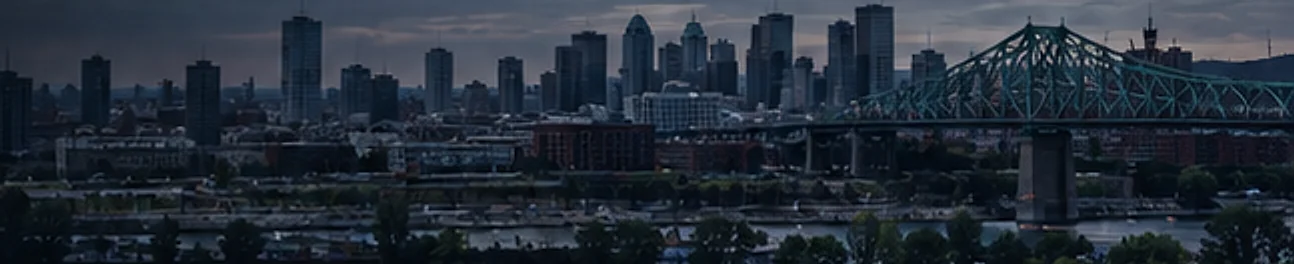
Established as a seigneury in 1668, Longueuil developed slowly until the 1847 railway and the Victoria Bridge, built between 1850 and 1860; its growth as a port town and railway bridgehead then became tied to Montreal’s, and was consolidated by the Jacques Cartier Bridge, inaugurated in 1930, whose south approach has a concrete deck and substructure. The Old Longueuil heritage site, cited in 1993, has more than 950 buildings, about 455 of them with strong heritage potential, clad mostly in brick, stone and wood siding. The Saint-Antoine stream there was filled in in 1957.
The City has four village cores: Greenfield Park, Le Moyne, Saint-Hubert and Old Longueuil. Labonté and De Maricourt streets group so-called “veterans’ houses”, and the Normandie and Bellerive developments were built in the late 1950s and early 1960s. The Seaway, the Louis-Hippolyte-La Fontaine bridge-tunnel, Route 132 and Autoroutes 10, 20 and 30 have also reshaped the urban landscape.
In Saint-Hubert, the airport inaugurated in 1927 hosted a military base whose facilities closed in 1968, the year Autoroute 30 was built. The airport area mixes low-density industrial, institutional, commercial and residential buildings, with the Canadian Space Agency headquarters since 1993 and large industrial buildings built since the beginning of the 21st century.
Medium-density residential complexes have recently been built near boulevard Vauquelin, rue du R-100 and city hall. For a recent structure, a first map can serve as a reference point for later campaigns, provided the grid, method and measurement conditions are recorded. For an older structure in Old Longueuil, point out the concrete elements added to a masonry building, such as balconies or garage slabs, so that what was measured is clearly identified.
Measuring corrosion activity
The ASTM C876 test method covers the estimation of the corrosion potential of uncoated reinforcing steel in concrete, for the purpose of determining its corrosion activity. Taken on a grid, these measurements produce a map of the surveyed surface.
Exposed slabs and parking garages
Parking garages are subject to specific obligations in Quebec: an annual visual verification and an in-depth verification report by an engineer every five years, according to the Régie du bâtiment du Québec. A corrosion map helps locate the zones to watch between these verifications.
- On a cracked or spalled parking slab
- Before planning concrete repairs
- To monitor an area that has already been repaired
Mapping method, process and limitations
How potential measurements work, how the survey runs, how to read the maps and their limitations are covered on our corrosion mapping in Quebec page. This page only covers what is specific to Longueuil.
Frequently asked questions
Does corrosion mapping indicate the strength of the structure?
Not directly. It provides information on the corrosion activity of the rebar; assessing structural capacity is an engineer’s responsibility.
Why combine it with a concrete scan?
Ground-penetrating radar locates the rebar and estimates its depth, which helps position corrosion measurements on the steel.
Is a corrosion map enough to price repairs?
No. It locates the surveyed areas and the indications recorded. Repair quantities and costs come from the engineer’s study and the specification.
Should previously repaired areas be included?
It helps to mark them on the plan. Depending on the objective, they may be measured for comparison or excluded; the deliverable should state this choice.
Sources
- ASTM C876-22b, Standard Test Method for Corrosion Potentials of Uncoated Reinforcing Steel in Concrete
- Régie du bâtiment du Québec: Parking garages, maintenance and inspection
- Ville de Longueuil: Construction, rénovation, démolition (in French)
- Répertoire du patrimoine culturel du Québec: Site patrimonial du Vieux-Longueuil (in French)
- Ville de Longueuil: Cadre de gestion du patrimoine architectural des sites patrimoniaux, 2018 (in French)
- Ville de Longueuil: Plan directeur de la zone d’innovation en aérospatiale (in French)
- The Jacques Cartier and Champlain Bridges Incorporated: Jacques Cartier Bridge, about
Contact
Your project starts here.
Tell us about your needs. Our team supports you with rigour and precision, wherever you are in Quebec.